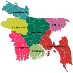
DHAKA DIVISION- 17 Districts
17 DISTRICTS OF DHAKA DIVISION

- Dhaka District:
Dhaka district was established in 1773, but it saw the Superintendent of Police (SP) from 1863. Lt. W. L. N. Knyvett was the first superintendent of Dhaka district Police. It has seven police stations- Savar Model, Ashulia, Dhamrai, Keranigonj Model, Dakhin Keranigonj, Nawabgonj and Dohar. It has two investigation centers and eight outposts including one river outpost. The National Mausoleum, the most adorable and highly sacred architecture of the nation, is situated at Ashulia. Jahangirnagar University, a renowned residential public university, is located at Ashulia. Ashulia is also the hub of garment industries.

2. Narayanganj District:
Narayanganj, having a jurisdiction over 759.57 sqkm area, was turned into a district in 1984 and later into a city corporation in 2011. The district is known as a city of garment industry as over 1100 factories are situated here. Worlds largest jute mill Adamjee is also situated here. Recently, the mill has been closed and its place has been turned into as Adamjee EPZ.Panam Nagar at Sonargaon, tomb of Sultan Gias Uddin Azam Shah, and fortress of Isha Khan at Hajiganj are renowned as places of historical interests in the district.The district police force was formed in 1984 with 7 police stations: Narayangonj Sadar, Fotulla, Bandar, Siddhirgonj, Araihazar, Sonargaon and Rupgonj; 11 camps, 3 inquiry centers.

3. Gazipur District:
Gazipur, having an area of 1741.53 sqkm, is the district of Dhaka division established in 1984. It has 2 cirlces, 6 police stations: Joydebpur, Tongi, Sreepur, Kaliakoir, Kapasia and Kaligonj. Recently, it has been declared as city corporation. Mymensingh and Kishorgonj districts on the north, Dhaka, Narayanganj and Narsindi districts on the south, Dhaka and Tangail districts on the west. Bangabandhu Sheikh Mujibur Rahman Agriculture University, Bangladesh Rice Research Institutre(BRRI), Bangladesh Agricultural Research(BARI) Institute are located here.

4. Manikganj District:
Manikganj, a district under Dhaka division, is situated beside the river Kaliganga. It has a unique natural landscaping due to the presence of a number of canals. Dhaka-Kolikata Road, the Asian highway runs through the northern side of the town. Manikganj was established as a subdivision of Dhaka district in 1845. It was turned into a district in 1984. The area of the town is 20.59 sq km. It has 2 circles, 7 police stations: Manikganj Sadar, Singair, Saturia, Harirampur, Shibalay, Doulotpur and Ghior; 1 town outpost, 2 investigation centers and 1 river traffic outpost at Paturia.

5. Munshiganj District:
Munshiganj district is a historically renowned place with fond memories of many renowned people, commemorating events. The district is a liberal Bongo realm of capital of Bikrompur which began from ancient Chandra governance to Pall, Sen, Moughol and the achievement of Brahman governances.Munshiganj district, formerly a subdivision under Dhaka district, was established in 1984. It has 2 circles, 6 police stations: Munshigonj Sadar, Tongibari, Louhojong, Gozaria, Sreenagar, Sirajdikhan, 1 investigation centre, 2 river outposts and 1 town outpost.

6. Narsingdi District:
Narsingdi is 50 km north-east of Dhaka, capital city of Bangladesh and a part of the Dhaka division. Narsingdi district police has 6 police stations: Narshingdi, Raypura, Shibpur, Belabo, Monohordi and Polash, 2 police investigation centres, 5 police outposts and 3 police camps.

7. Mymensingh District:
The greater Mymensingh district was established in 1787. Later on it was divided into six separate districts, one of them being the current Mymensingh district. It is located to the north of capital Dhaka. It has a diverse landscape of valleys and hilly terrains.There are a total of 4 police circles and 14 police stations: Kotwali, Muktagacha, Fulbaria, Pagla,Trishal, Gouripur, Ishorgonj, Nandail, Fulpur, Haluaghat, Dhubaora, Goforgaon, Valuka and Tarakanda in Mymensingh. Support is provided by 2 police outposts and local investigation is carried out by 4 investigation centers placed throughout the district. The police force in Mymensingh made huge sacrifices in 1971, with a total of 31 policemen being martyred by the Pakistani military. Among them were 4 Sub Inspectors, 3 Assistant Sub Inspectors, and 24 Constables.

8. Tangail District:
Tangail subdivision was established in 1870 and was turned into a district in 1969. The over-all area of the district is 3414.35 sq km, with a population of 36,05,083. One of the major infrastructure that exist in Tangail is Bangobandhu Bridge. It has been declared as a Key Point Installation (KPI) due to its strategic importance in the communication and transportation sector and its overall impact on the economy. Tangail district police also started its journey on 1st December 1969 and comprised of a total of 13 police stations: Sadar, Mirzapur, Nagarpur, Sokhipur, Basail, Delduar, Modhupur, Ghatail, Kalihati, Bhuapur, Bangabandhu Bridge east, Dhonbari and Gopalpur under 03 circles.

9. Kishoregonj District:
Established in 1984, Kishoregonj is surrounded by Netrakona and Mymensingh districts on the north, Narsingdi on the south west, Brahmanbaria on the south east, Sunamganj and Habiganj on the east, Gazipur and Mymensingh on the west. The district police consists of 13 police stations including two model thanas. The police stations are Kishoregonj Model, Karimganj, Tarail, Hossainpur, Pakundia, Katiadi model, Bajitpur, Kuliarchar, Bhairab, Austagram, Mithamoin, Itna and Nikli. Four circle ASPs are continuously monitoring and supervising all these police stations.

10. Netrokona District:
Netrokona subdivision was established in 1882 and was turned into a district in 1984. It is situated in the northern part of Bangladesh, near the Himalayan border. Although the majority of the population is Bangladeshis, the presence of ethnic groups such as Garo and Hajong is also prominent in the district. The ethnic groups mostly live near Durgapur, around the Garo Hills. Presence of Garo Hills and places like Birishiri attracts quite a lot of tourists. The district police consists of 10 police stations including one model thana. Three circle ASPs are continuously monitoring and supervising all these police stations. These circles are: Sadar circle with 4 police stations, Barhatta circle with 3 police stations and Khaliajuri circle with 3 police stations as well. The police stations are Netrokona model, Purbodhola, Durgapur, Kendua, Barhatta, Atpara, Kalmakanda, Mohongonj, Madan, Khaliajuri.

11. Sherpur District:
Established in 1984, the district is situated on the northern part of Bangladesh under Dhaka division. It is surrounded by Garo Hills of Meghalaya (India) on the North, Mymensingh on the east and Jamalpur on the west. The district police started its journey in the same year with five police stations – Jhenaigati, Nakla, Nalitabari, Sherpur Sadar and Sreebardi; two outposts – Sherpur sadar fari and Gouripur fari; 1 investigation centre, one immigration check post.

12. Jamalpur District:
Jamalpur, with an area of 2115.16 sqkm, became a fully-fledged district in 1978 after being separated from the greater Mymensingh. Jamuna, the biggest fertilizer factory in Asia, is situated at Sharishabari upazila in the district. The entire community of the district receives law and order service from 08 police stations: Jamalpur, Melandoho, Sarishabari, Dewangonj, Islampur, Madargonj, Bakshigonj and bahadurabad, 02 outposts under 02 circles. The office of district Superintendent of Police(SP) is situated beside the sacred grave of Hazrat Shah Jamal (RA) and on the bank of Brahmaputra.

13. Faridpur District:
Faridpur District, named after famous Sufi saint Shah Sheikh Fariuddin, stands in the west of Dhaka division. Bangabandhu Sheikh Mujibur Rahman, founder of Bangladesh, and Fazlur Rahman Khan, Bangladeshi born American archietect, were sons of greater Faridpur. Mosque, Temple, Church, Tomb and several sacred places like Bismillah Dargha, Sheikh Farid Dargha, Majloish-e-Aloulia Dargah are situated here. An annual fair, Jasim Pollimela, takes place here to commemorate the birth of renowned Bangalee poet Josimuddin.District police consists of 09 police stations: Kotwali, Modhukhali, Boalmari, Alfadanga, Char Vodrason, Nagarkanda, Sadarpur, Saltha and Bhanga under two circles.

14. Gopalgonj District:
Gopalganj district police has an important place in the history of Bangladesh and a distinctive position among police force in 64 districts as it is the birth place of Father of the nation Bangabondhu Sheikh Mujibur Rahman and Prime Minister Sheikh Hasina.The district police force came into being in 1984. Its role is not merely restricted to prevention of crimes and maintaining law and order but also providing VIP protection as the President, Prime minister, foreign dignitaries frequently visits Tungipara to pay homage to the shrine of Father of the Nation Bangabondu Sheikh Mujibur Rahman.There are 05 police stations: Gopalgonj, Mokshudpur, Kashiani, Kotalipara and Tongipara under 01 circle.

15. Madaripur District:
Madaripur as a subdivition began its journey in 1854. In 1984 it was turned into a district. It was named as a Madaripur district after Sufi saint Badruddin shah Madar (15th c). Its total area is 1,144 sq km.From the very beginning, Madaripur district police kicked off its administrative work and now it comprises 01 circle including 05 police stations: Madaripur Sadar, Rajoir, Kalkini, Chashar and Shibchar; 03 town out posts, 05 investigation centers and 01 river out post.

16. Shoriotpur District:
Shariatpur district was named after Haji Shariatullah (1781-1840), the founder of Faraizi Movement and an eminent Islamic reformer during British Raj. Shariatpur was established as district on March1,1984. Earlier it was known as Palong Thana under Faridpur sub-division. There are seven police stations: Palong, Naria, Janjira, Vedorgong, Damudya, Gosairhat and Shakhipur, and six upazilas- Palong, Naria, Janjira, Vedorgong, Damudya, Gosairhat. Burirhat Mosque in Palong, Kartikpur Zaminderbari in Naria, Haturia Zaminderbari in sairhat are few places of historical importance in the district.

17. Rajbari District:
Rajbari district police started its journey in 1984.It has one circle named Rajbari sadar.It has five police stations,one town outpost,one river outpost and three investigation centers.The police stations are Rajbari,Goalondoghat,Baliakandi,Pansha and Kalukhali.